The Disaster in North Carolina Is a Climate Warning
4 min read
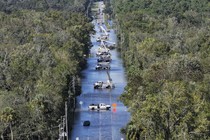
When Helene swept through western North Carolina late last week, the rain fell heavy and fast enough to start washing away mountainsides. Rivers overflowed, and a chunk of one of the state’s major highways collapsed, cutting off communities; floods slung mud and muck into buildings. Cars, trucks, dumpsters, entire homes and bridges—these and more were carried away in the floods as if they weighed nothing. Much of what managed to stay in place became submerged in brown water. Thousands of people in Asheville remain without power, and boil-water advisories are in effect; evidence suggests that the city’s water system was severely damaged. Asheville’s River Arts District has been destroyed. At least 35 people in the region have died, and with cell service down, hundreds more are unaccounted for.
When a hurricane barrels toward land, “we really focus on the coast,” Michael Lowry, a hurricane specialist in Miami, told me as Helene headed toward the continental United States. But the inland impact “can’t be overstated,” especially in heavily wooded areas, where fallen trees can exacerbate the destruction. Before the giant hurricane even came ashore, North Carolina had endured a miserable amount of rainfall. On Friday morning, rivers in western North Carolina were already at record levels, and officials for a time feared that a dam at Lake Lure, which is surrounded by dense forest, would fail. Helene had weakened to a tropical storm by the time it reached the mountains, but this much more water was simply too much.
Excessive rainfall can weaken soil and force once-sturdy ground to slide away with terrifying swiftness; scientists have linked both extreme rainfall and increased risk of landslides to climate change. (A recent study found, for instance, that the rainfall that triggered a series of landslides in India this summer, killing hundreds, was made 10 percent heavier as a result of human-caused climate change.) That Helene affected western North Carolina so dramatically may force more people to incorporate those dynamics into their understanding of climate effects. For years, climate scientists warned that rising sea levels would worsen coastal flooding during hurricanes, and indeed, Helene broke storm-surge records along Florida’s Gulf Coast, some of which were set only a year ago. But one of the places still reeling most dramatically from Helene’s wrath are the southern Appalachian Mountains.
Helene bore some of the hallmarks of a hurricane in a too-warm world, such as rapid intensification. The hurricane drew fuel from abnormally warm waters in the Gulf of Mexico, which likely helped extend the storm’s life. A study examining hurricanes that made landfall between 1967 and 2018, for example, found that modern-day hurricanes extend farther inland because they contain more moisture collected during their journey over warmer seas. Hurricanes are now decaying at a slower rate after traveling inland.
As some powerful hurricanes are known to do, Helene generated wet weather in North Carolina that arrived far ahead of the main system. This particular storm front delivered enough rain to prompt a rare advisory from the National Oceanic and Atmospheric Administration about flood risk in urban areas including parts of the southern Appalachians. The rains “have left the grounds saturated and the river tributaries running high,” and the coming deluge was only going to make things worse, “even well after landfall,” the agency warned as Helene approached.
The flooding that followed has drawn comparisons to Asheville’s dramatic 1916 flood, brought on by back-to-back tropical storms, which killed 80 people and stood as the city’s benchmark for all subsequent flooding events. That flood “carved away the ground under mountain railroad passes, leaving tracks looking like sky-high trapeze rigs,” according to one historical account. These types of disasters don’t depend only on human-caused warming: Severe precipitation will always be influenced by natural weather patterns and happenstance. But climate change is opening the tap wider.
When temperatures rise, more water evaporates from Earth’s surface and its oceans. A warmer atmosphere can hold more moisture, and that excess moisture can contribute to more frequent and intense rainfall. Such conditions are supercharging rainy weather, tropical storms, and Category 4 hurricanes alike. A passing hurricane can wreak even more havoc if the land below is already soaked and its waterways are filled to the brim. A mountainous and temperate region such as western North Carolina might not have to worry as much about rising seas or scorching temperatures—Asheville has been described as a climate haven because it seems relatively protected from the most commonly cited effects of global warming, such as extreme heat and hurricane winds. But these places still have to contend with excessive rain and the resulting landslides, a deadly combination of land and water that can make the ground slip out from under whole communities.
As the floodwaters in North Carolina recede, more storms are already brewing in the Atlantic, with forecasters tracking which cyclones may pose a threat to the Gulf Coast. If a storm strengthens into a hurricane and makes landfall, it will become the fifth hurricane to reach the U.S. mainland this year, rivaling the record of six landfalls in a single season. There doesn’t appear to be a connection between climate effects and landfalls, but too many landfalls is worrying because the storms that arrive are stronger than they should be. Parts of the Southeast still cleaning up after Helene may be walloped again, with waves crashing on their doorstep as if the sea itself were knocking. One stretch of coastal Florida was still recovering from two other hurricanes when Helene swept through. Two months remain in the Atlantic hurricane season. It may still render communities inundated and stranded, with water so high that it is difficult to fathom how it can drain away, and what will remain once it does.


